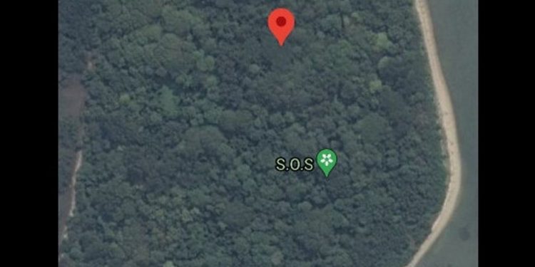
Operations Director of Basarnas, Brigadier General Rasman, admitted that his party had not received an official report on the SOS sign that appeared on Laki Island thorugh the Google Maps application.
It is known, Laki Island is one of the islands close to the crash point of the Sriwijaya Air SJ-182 plane. Because it was viral on social media, Rasman said that his party would find out the source of the SOS sign.
“Until now, I have not received the information, I have not received the data. For the SOS sign, we will try to explore it according to the information given earlier,” said Rasman at the JICT II Integrated Command Post, North Jakarta, Wednesday, January 20.
Rasman said he was reluctant to speculate about the possibility of a Sriwijaya Air SJ-182 passenger who was still alive based on the SOS sign that appeared.
Moreover, he said, the sign could have been made by one of the SAR teams who were on duty to search for victims and materials from the Sriwijaya Air plane that crashed on Saturday, January 9.
“It could be that there are also our friends who are there. For your information, our rescue team or dive team has a post on Lancang Island, Laki Island, then some are in Tanjung Kait, “explained Rasman.
Recently, netizens were shocked with an SOS sign, which is located on Laki Island.
In an emergency, the SOS sign is usually used by someone to ask for help. SOS stands for “save our souls”.
Citizens shared a screenshot of Google Maps from the SOS point on Twitter, Instagram and TikTok. They linked it to the possibility of survivors from the Sriwijaya Air SJ-182 incident which fell on January 9.


